EcoNet
Our Solutions
CAMS = Conservation Activity Management System
- the software conservation needs
CAMS is continuously improving and improving the efficiency of conservation work. EcoNet provides several solutions, most free to user to enable more efficient environmental management.
CAMS Public Toolkit
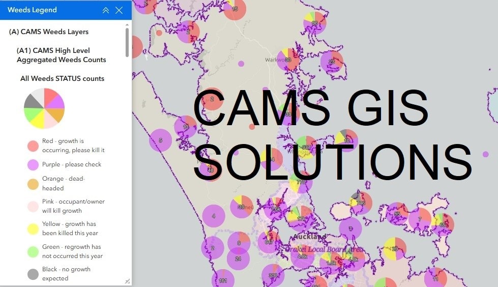
CAMS Public – built in ArcGIS Hub Premium – enables free access to CAMS Public Weed Action maps to edit a limited set of public weed data, as well as dashboards with aggregated statistics, and field maps for finding the weeds in the field. The public map displays public iNaturalist records for selected weeds including mothplant, old man’s beard and woolly nightshade. It also shows weeds from CAMS Community which are marked as Open. CAMS Public is now available for anyone to use. Please send any feedback to systems@econet.nz.
CAMS Community Toolkit
CAMS Community enables verified users free access to the complete CAMS Community Weed Maps and dashboards via your browser or via ArcGIS Field Maps on your mobile device – eg phone, iPad. CAMS Community Weed Maps provide the tools you need to record and manage weeds over the lifespan of the weed and its seed bank. With its unique weed status display, CAMS provides the data that you and your team need to tell the status of a weed patch at any time. CAMS tools allow you to record the status of weeds in the field, develop weed work plans at your home or report on aggregate weed counts across an area. We now have iNaturalist integration enabling entry of data via iNaturalist, synching selected weeds into CAMS Community Weed Maps. Already, hundreds of people are using CAMS Community Weed Maps to locate and record action on pest plants. CAMS Community Toolkit v0.8 is now available to all verified users.
Key new features include:
- New popup displays past visit dates clearly
- New popup shows iNaturalist photo if entered via iNaturalist
- New Easy Updater makes editing a weed instance super quick and easy
- New fields in the AGOL GIS form for power users
- Indicator of months since last visit
- Indicator that next visit date is passed
- All new dashboards filter by region, district, places, weed, and status
- New Stamping Ground Maps (volunteer work areas) and the ability to add/edit your own Stamping Ground
For more information and to become a verified user please see our CAMS sign up site.
CAMS Premium Toolkit
CAMS Premium allows advanced conservation groups access more advanced features for a small annual support fee. Features include CAMS Places with synch to CAMS Connections, Views of data filtered for your conservation group, Capture my Path, CAMS Plans and Problems (beta). We also have Trap.nz dashboards and Bird count dashboards in development. Email systems@econet.nz to explore CAMS Premium further.
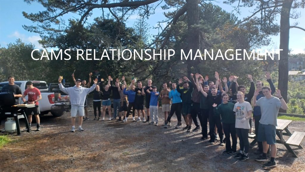
CAMS Connections - CRM - contact management system
CAMS Connections is a fully configured Microsoft contact management system with some integrations with GIS. CAMS Connections for conservation is built on Microsoft Dynamics 365, and now integrated with Mailchimp marketing software. This enables contact management, integrated emailing, centralised contact list, cross organisation visibility of interests, groups, skills, agreements, tool library, actions recording, health & safety plans, incident reporting and more. All of this is is reported seemlessly in Power BI. Conservation groups now have a 360 degree view of people, projects, inputs and impact. CAMS Connections is in use by five conservation groups, one of which has 6000 contacts. The CRM has revolutionised the way these conservation groups engage, record and report data. CAMS Premium includes mapping of locations which synchronise through to CRM. Email us at systems@econet.nz to find our more.
Click on any of the images below to view a PDF about CAMS Connections or CAMS GIS Toolkits
Some of the organisations using CAMS:
- Pest Free Kaipātiki Restoration Society
- Restore Hibiscus & Bays
- Matuku Link
- Environmental Weed Coalition
- Campbells Bay Urban Sanctuary
- Weed Action Natural Habitats Restoration Trust (Whangarei)
- Motutapu Restoration Trust
- Motuihe Project
- Rotoroa Island
- Kawau Weedbusters
- Hidden Valley Conservation Trust
- Old Mans Beard Free Wellington
- Society Totally Against Mothplant (STAMP)
- Upper Waitematā Ecology Network
- The Learning Environment
- and hundreds of individuals