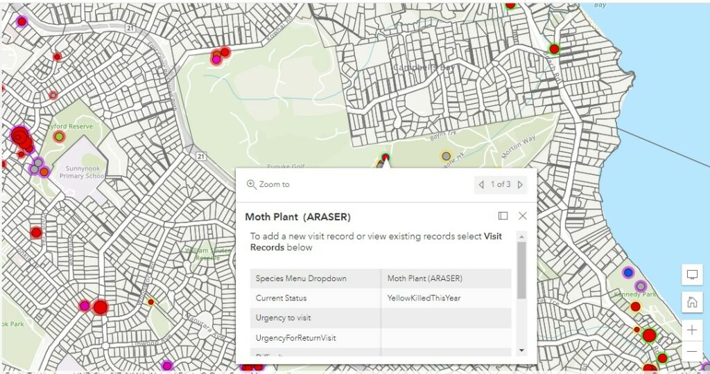
CAMS GIS has its first tool available now in beta. CAMS Weed App is on desktop as an ArcGIS Web App and also on ArcGIS Field Maps. This app enables users to record a weed site, details around the location and property and to record actions on the weed in real time. It is in use by the STAMP moth plant team and other test users with other pest plants. CAMS weed app is one of many in our development road map. EcoNet can arrange access for your to the weed app for a small fee. Some umbrella groups are funding access so if you are part of one please ask them. Please contact us on office@econet.nz for more information.